 4 weeks ago
36
4 weeks ago
36
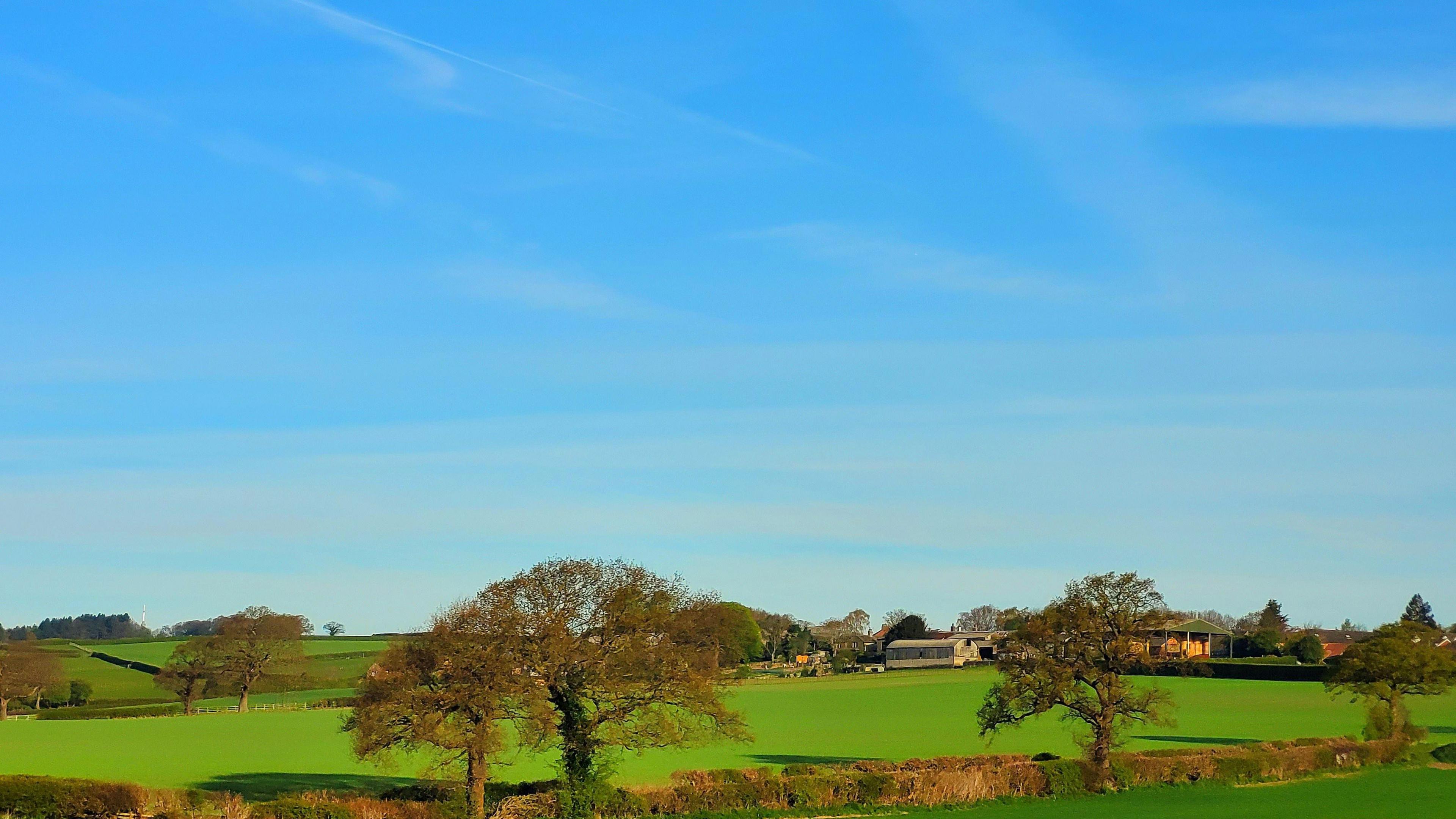 Image source, BBC Weather Watchers / YorkshireTed
Elizabeth Rizzini
Lead Weather Presenter
It has been been dry, sunny and warm since the start of the month for many of us but change is on the way this weekend.
Temperatures have been well above the April average this week. Thursday was the warmest day of the year so far in Scotland and Northern Ireland with 23C (73F ) recorded in Aboyne and 22C (72F) in Castlederg.
On Friday, the warmth spread further south and Wales recorded its joint highest temperature of the year so far with 22.4C at Usk in Monmouthshire.
You will have noticed too some huge temperature swings between day and night. In Aboyne in Aberdeenshire on Thursday there was a temperature difference of 26C. This is known as the diurnal range.
It is not rare in spring to have a large diurnal range but it is unusual just how dry and sunny it has been lately. Some spots across southern England haven't seen any appreciable rainfall since 23 March.
April has been particularly sunny. The first 10 days have seen over 100 hours in most places. Some spots have seen 80-85% of the monthly average sunshine already even though we are only a third of the way through the month.
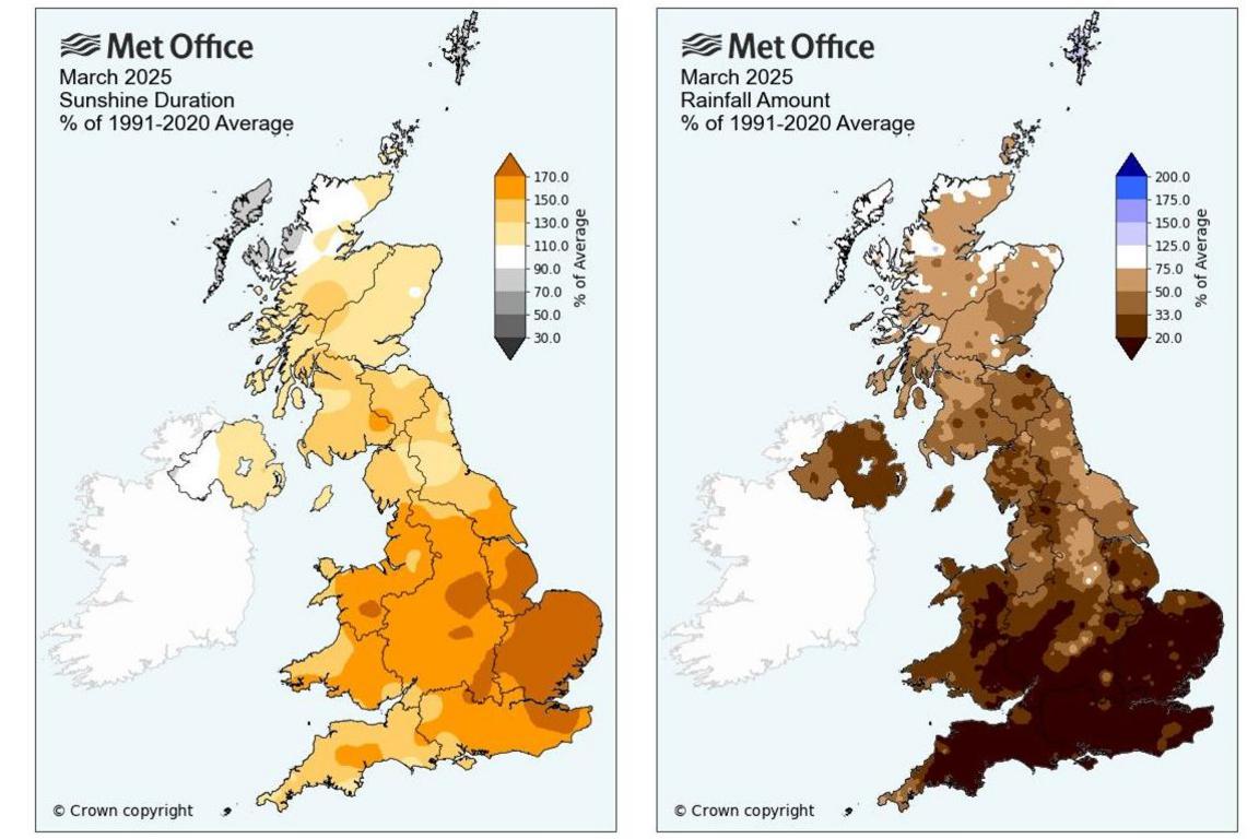 Image source, Crown
It is not just April that has been sunny and dry. March was the sunniest on record for England and the third sunniest for the UK as a whole. Records began in 1910. In terms of rainfall, only Scotland recorded more than half the monthly average.
Why has it been like this?
 Image source, Adriel Perdoma EPA-EFE/REX/Shutterstock
Tinajo in Lanzarote on 3 April 2025 when hurricane force winds and heavy rain from Storm Nuria battered the Canaries. Earlier this week Storm Olivier brought more rain and Tenerife South Airport recorded its wettest April day on record.
High pressure has been dominating our weather keeping us dry and settled.
These large areas of high pressure have blocked weather systems arriving from the west. It has resulted in the jet stream, which normally propels wind and rain towards us being locked in place for an extended period towards the north of the UK.
The meandering jet stream across the UK has also been responsible for sending low pressure systems towards the Canaries and Iberia which by contrast have seen some stormy weather.
What's going to change?
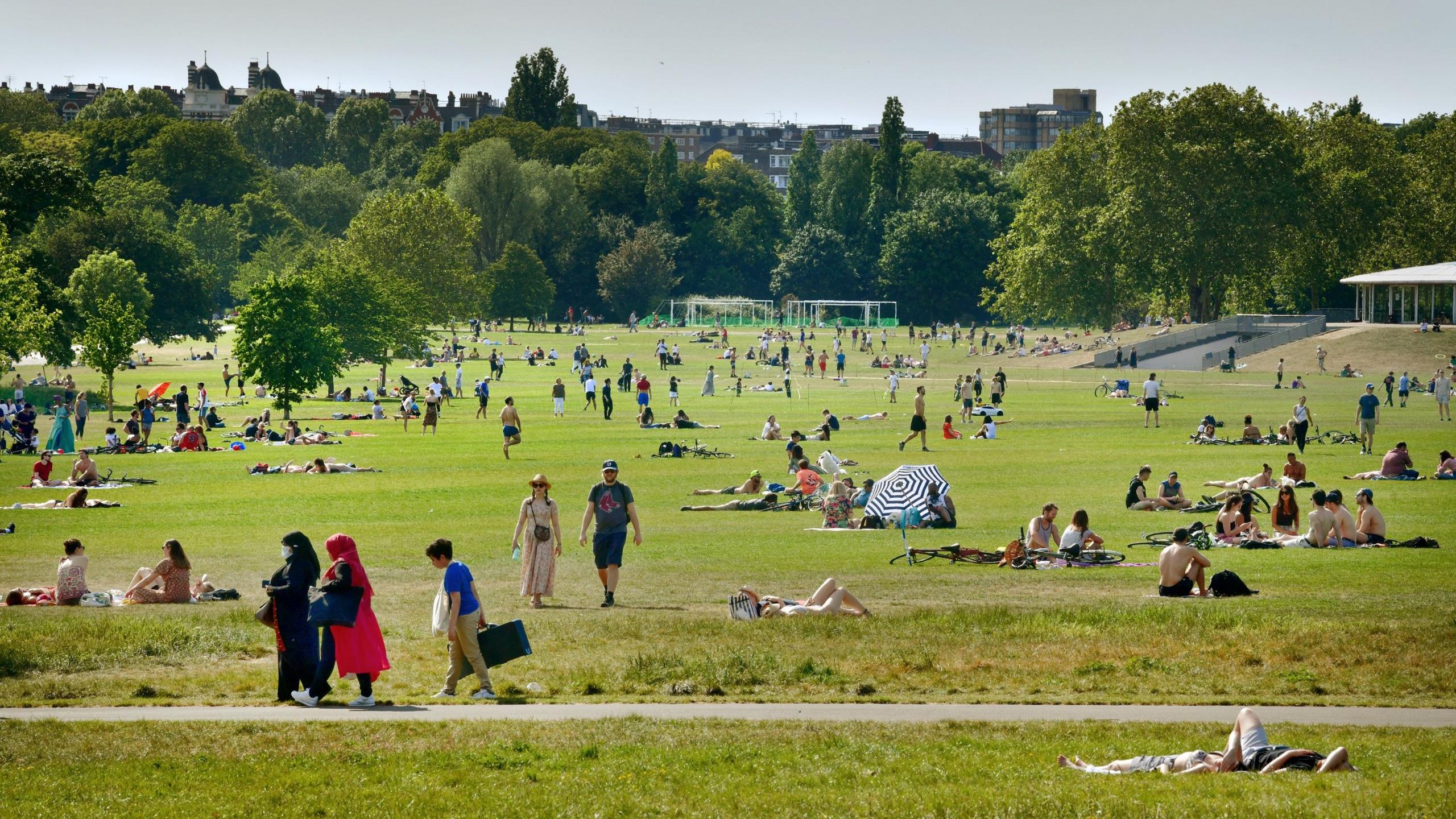
 Image source, BBC Weather Watchers / yorkshireTed
Blue sky and sunshine on Friday afternoon in Harrogate, North Yorkshire
Over the weekend, high pressure will pull away towards the east. This will allow weather fronts to approach from the west.
By Saturday morning, there will be cloud and outbreaks of rain across the far south-west of England. This rain will then move north-eastwards across Wales, Northern Ireland and into north-west England through the afternoon.
Despite a bright start, the western half of the UK will turn rather cloudy. The best of the sunshine and the warmest conditions will hang on across the far south-east of England which could still see highs of 22C (72F).
On Saturday night, the cloud and rain will push eastwards across the UK and Sunday will see areas of lingering cloud, sunny spells and showers. It will feel fresher for all with highs of 11-18C.
While a lot of the rain will be light and patchy and some places will escape it altogether, this weekend heralds a return to more typical April conditions. Rather than the wall-to-wall sunshine of late, there will be cloud, fresh south-westerly winds and some more appreciable, much-needed rainfall for the parched ground at the start of the new week.
What can we expect?
May 2020 was the sunniest calendar month in the UK on record since records began in 1910. It coincided with lockdown.
Does a dry, sunny warm spring lead to a wet summer?
The weather historian, Philip Eden, has claimed there is a link but most experts are far more cautious.
Remember lockdown exercise in the sunshine? The spring of 2020 was the sunniest on record in the UK with May 2020 the sunniest calendar month on record since records began in 1910. The following summer was, albeit circumstantially, wetter, duller and slightly warmer than average.
However, while May 2024 was the warmest on record since records began in 1884, the month before, April, was dull and wet and this led to a cooler than average summer with rainfall and sunshine about average.
Our BBC Weather longer range forecast suggests that there is the chance of a short cold spell in May so temperatures for spring as a whole could level out and fall closer to average.
Rainfall amounts should be near to below average overall, with April likely to be the driest month.
Easter egg hunting in the rain?
While many parents and children will be pleased to have caught at least a week of school holiday sunshine, the following week looms with no prospect of more sunny and warm April weather.
It is set to stay changeable and unsettled with showers and longer spells of rain at times through to the Easter bank holiday weekend. Temperatures will be more or less the seasonal average in the low to the mid teens in Celsius.
Check the forecast for your local area here or on the BBC Weather app.