 1 month ago
46
1 month ago
46
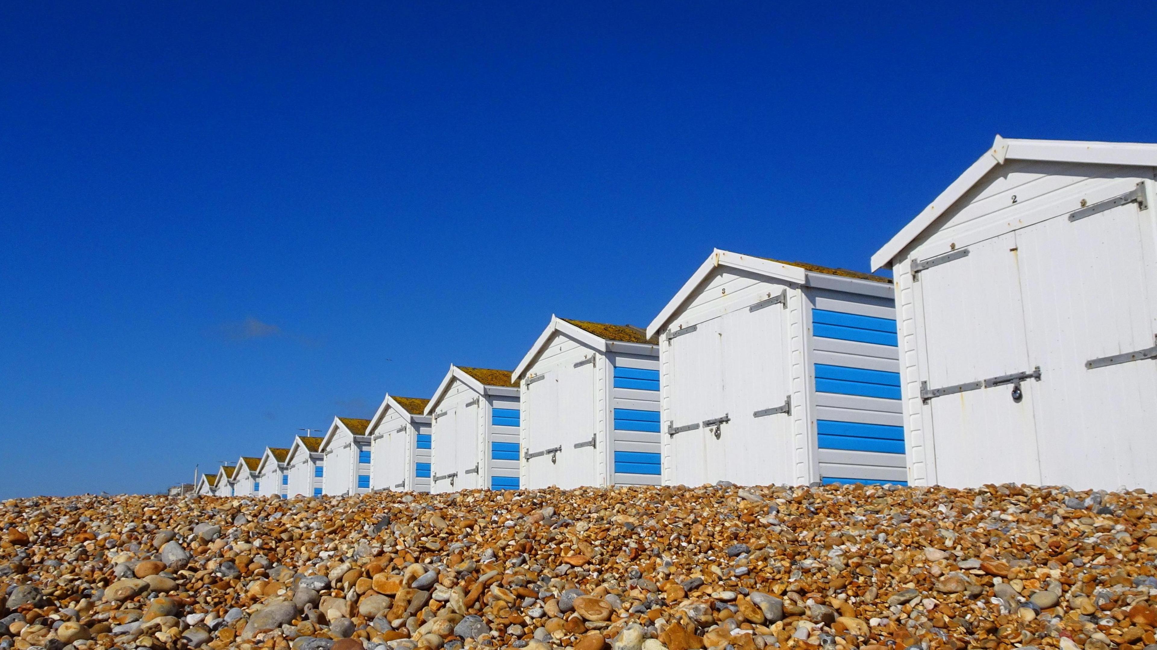 Image source, BBC Weather Watchers / Peter and Leah
Ben Rich
Lead Weather Presenter
April arrives next week and it looks set to bring a burst of spring warmth.
High pressure and a feed of south-easterly winds could lift temperatures to 22C (72F) in some places.
Largely dry conditions are expected with plenty of sunshine.
It is possible that we could see the UK's warmest weather of the year so far but there is uncertainty about just how warm it will get - and how long it might last.
Warming up during a mixed weekend
On Saturday high pressure will sit to the south of the UK with an area of low pressure moving across northern parts.
That means cloud and outbreaks of rain will affect Scotland and Northern Ireland - potentially spoiling the chance to witness the partial solar eclipse - and will spread into Wales, northern and western England during the afternoon.
The best of the sunshine will be found across south-east England and East Anglia.
British Summer Time (BST) arrives on Sunday as the clocks go forward and high pressure will start to build a little more strongly.
Most places will be dry with patchy cloud and sunny spells. Temperatures will climb a little reaching highs of 18C (64F) in parts of southern and eastern England.
Even warmer next week
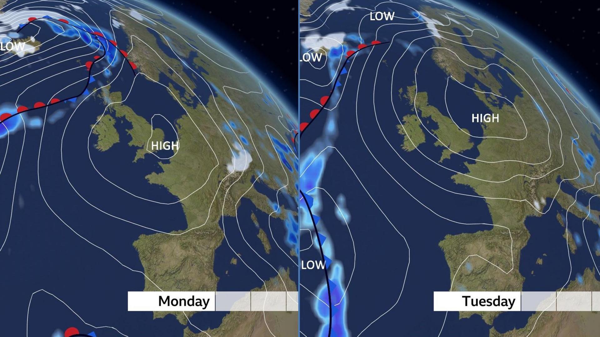
High pressure tends to bring dry, settled weather
As high pressure moves north-eastwards during Monday and Tuesday the wind direction will change - from westerly to south-easterly.
This will bring a feed of dry and warm air from continental Europe which should gradually clear most of the cloud allowing for more blue sky and sunshine.
Temperatures will also climb and are expected to peak on Wednesday or Thursday.
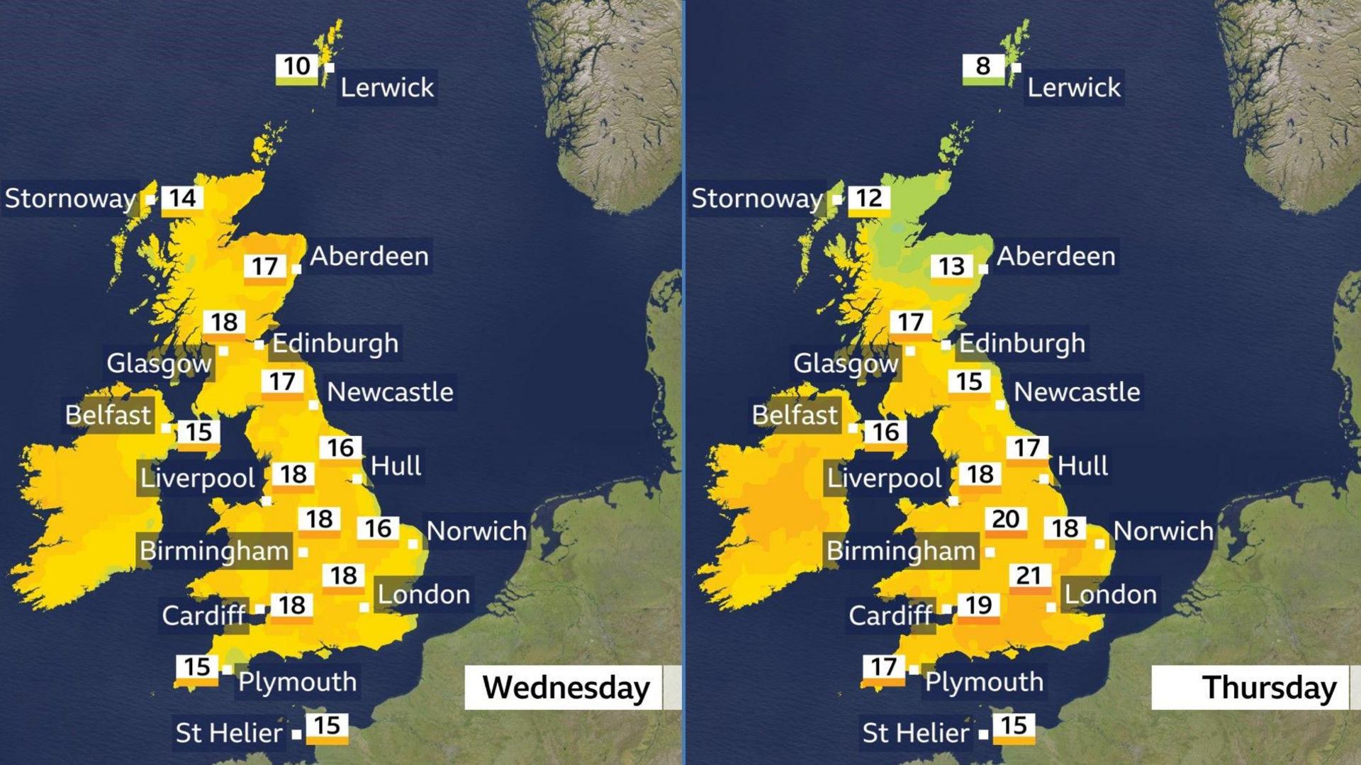
All four nations of the UK are set to reach the high-teens or low-twenties Celsius
At this range there is uncertainty about just how warm it will get but some places look likely to reach 21-22C (70-72F) - potentially the highest temperatures of the year so far.
The current maximum for 2025 came on the spring equinox - 20 March - when Northolt (London) and Chertsey (Surrey) saw highs of 21.3C (70.3F).
Warm, dry weather is not good news for everyone though.
High pollen levels will mean tricky conditions for some hay fever sufferers, and with the sun gaining strength at this time of year, UV levels are likely to be moderate.
Is this warmth unusual?
Temperatures are forecast to be several degrees above the average daytime highs for early April which are typically around 9-14C (48-57F).
However spring is a transition season and tends to bring big temperature swings meaning spells of warm weather are expected - along with some colder periods.
It is very unlikely that we will challenge the UK's highest April temperature on record: 29.4C (84.9F) at Camden Square (London) on 16 April 1949.
Will it last?
Computer weather models are in disagreement about how long this spell of settled weather will continue.
Some suggest that high pressure will drift away eastwards by the end of next week keeping things fairly warm but also bringing bands of cloud and outbreaks of rain.
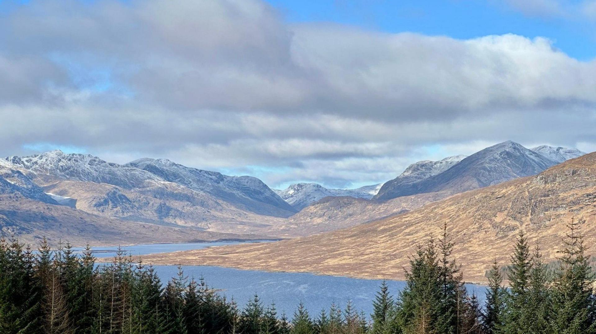 Image source, BBC Weather Watchers / Curly Claire
Colder weather and wintry showers could still return
Other forecasts instead build high pressure to the north-west of the UK bringing a return of northerly winds, which would mean lower temperatures and perhaps even some wintry showers.
So with a lot still to play for it will be worth keeping up to date with the forecast at BBC Weather online and on the app.