 3 months ago
96
3 months ago
96
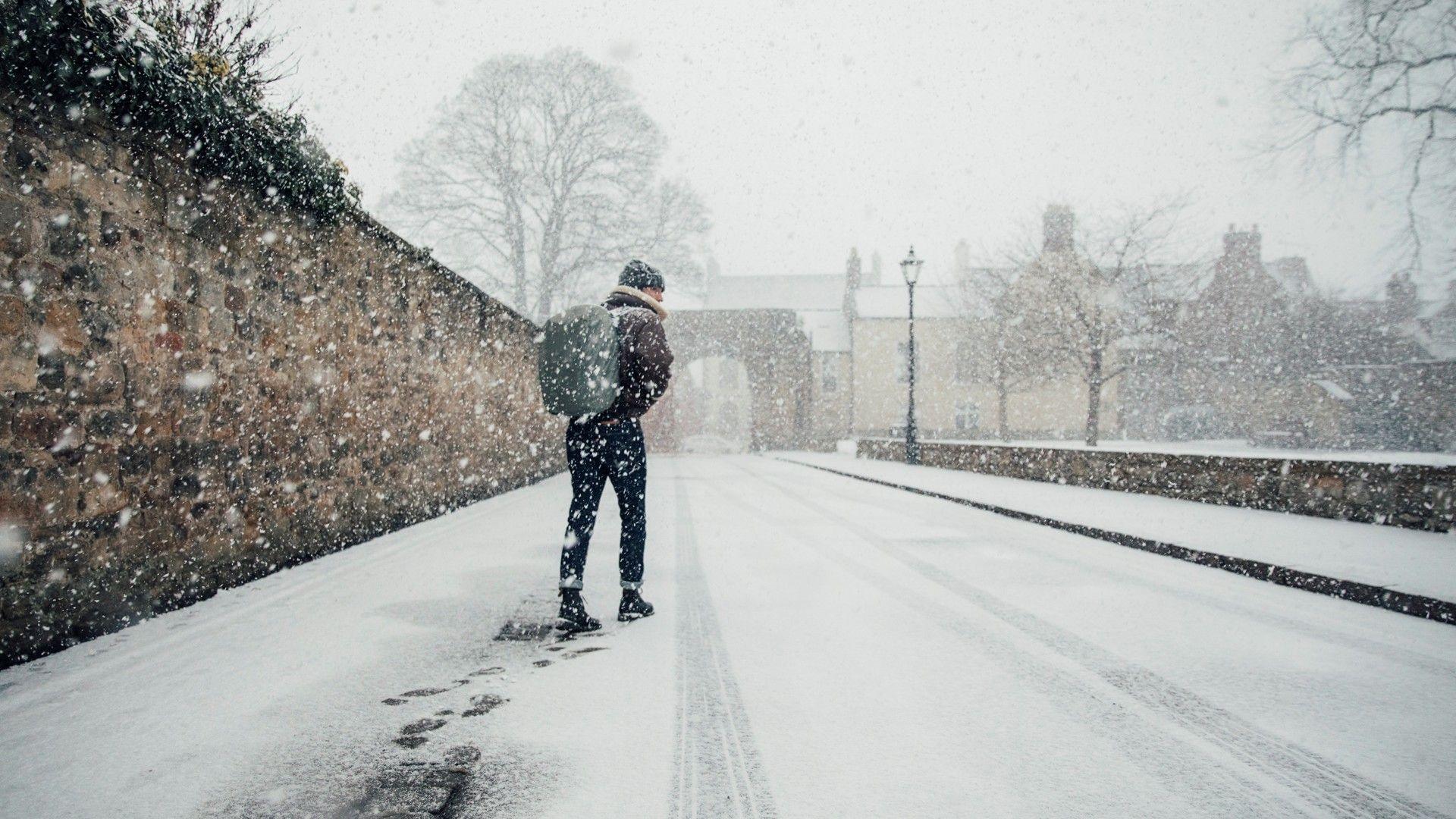 Image source, Getty Images
A lone walker trudges through the snow in this scene from Northumberland
ByMatt Taylor
Lead Weather Presenter
The Met Office is warning of disruption to travel on Monday morning as many people return to work and school following the Christmas break.
Amber warnings for more snow have been issued in northern Scotland after several days of heavy snow.
New snowfalls are also possible across England and Wales through the coming week, despite temperatures lifting a little.
Later in the week strong winds and heavy rain could bring an additional hazard as a deep area of low pressure sweeps across the UK.
 Image source, BBC Weather Watchers/ chrisx30
Locals in Llanberis, Gwynedd, north west Wales, woke up to a deep covering of snow on Sunday
Strong winds causing drifting
Met Office amber weather warnings have been issued for snow across Shetland, Orkney and parts of northern mainland Scotland from 1800 on Sunday until 1000 on Monday.
Heavy snowfall over recent days has resulted in over 40cm reported in parts of Moray already.
Strong winds have been causing drifting, with Network Rail Scotland reporting snow drifts up to 1.2m (4ft) on the line between Aberdeen and Dundee.
As the snow showers become heavier and more frequent during Sunday night, the Met Office is warning for the potential of another 20 to 30cm of snow.
Further road and rail closures are also possible and disruption to power is likely in some areas too.
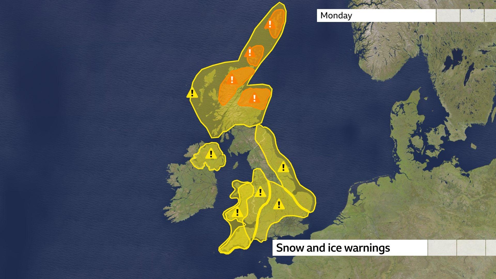
Most areas of the UK are covered by Met Office snow and ice warnings on Monday
Numerous yellow weather warnings for snow and ice have also been issued in each of the four nations, with the Met Office highlighting the risk of longer journey times by road and rail on Monday morning, as well as the potential for slips and falls on pavements and cycle routes.
Most parts of the UK will be fairly sunny by day, but light snow flurries will affect the far north of Scotland, west Wales and some eastern counties of England.
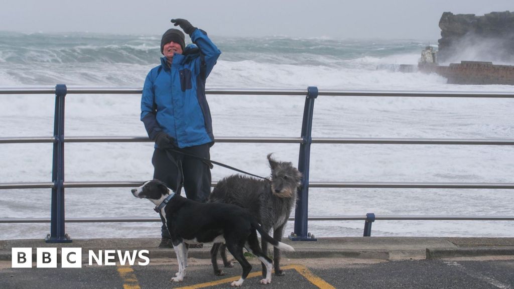
 Image source, BBC Weather Watchers / frazmanscoop
There were no signs of drivers on this snow-covered country road in Orkney
How long will cold weather last?
Clear skies on Saturday night brought plunging temperatures as England and Wales registered their coldest night of winter so far. The mercury dropped to minus 9.3C at Benson in Oxfordshire and minus 7.3C at Sennybridge in Powys.
Sunday night into Monday morning could be even colder as temperatures are forecast to drop to minus 10 or minus 11C in some rural parts of Scotland and Wales.
Although temperatures will slowly lift through the rest of this week, cold health alerts from the UK Health Security Agency remain in place across all of England until Friday.
The HSA warns that the prolonged cold spell could lead a rise in deaths, particularly amongst the elderly or those with underlying health conditions.
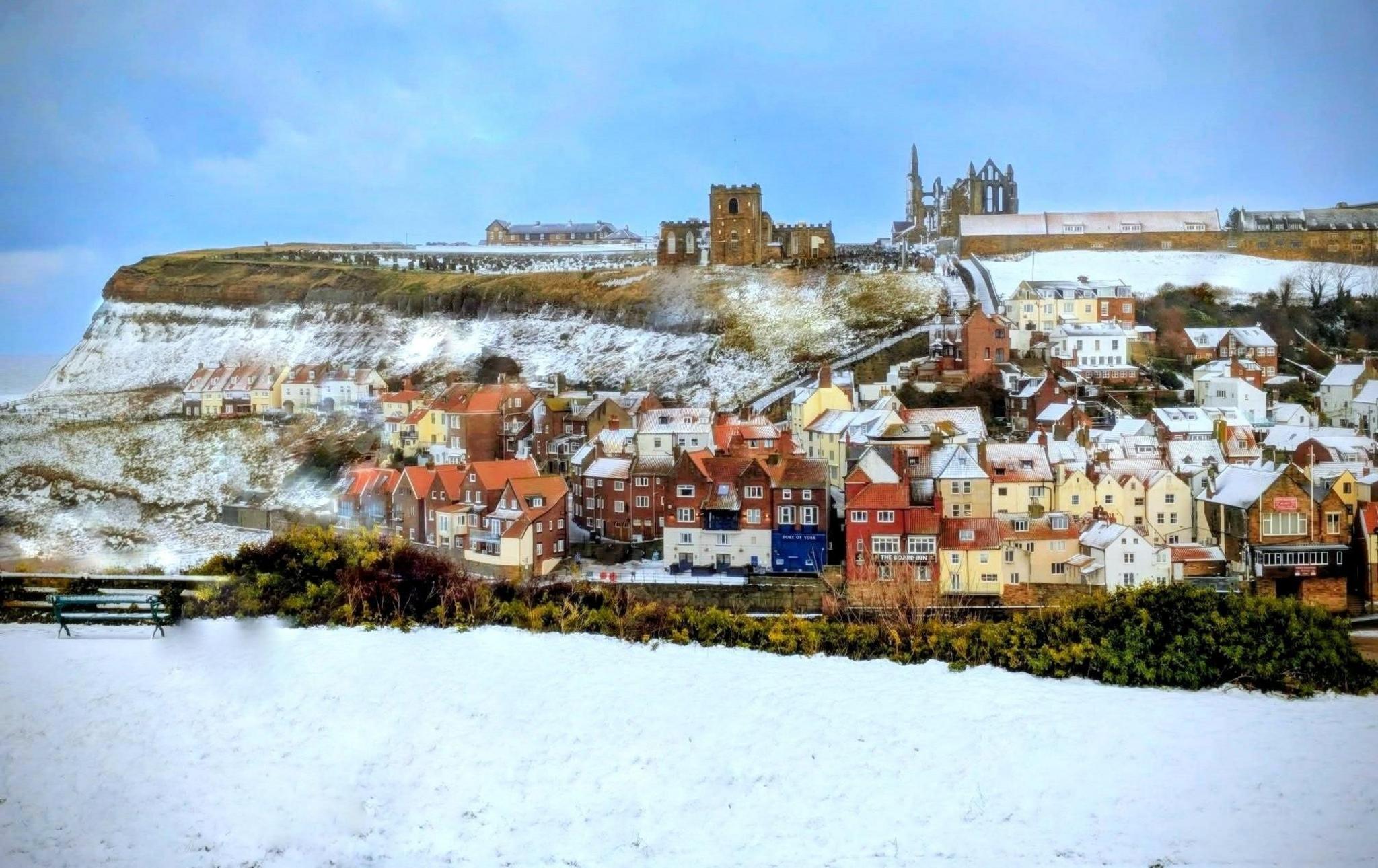 Image source, BBC Weather Watchers / silver surfer
Houses in Whitby, North Yorkshire, provided a splash of colour amid the snowfall
Will snow, sleet or rain fall?
Atlantic weather fronts are likely to bring more snow through this week.
The difficulty for forecasters will be pinpointing the fine temperature boundaries that dictate where snow, sleet or rain falls.
The coldest air is likely to persist over the northern half of the UK and bands of snow of varying intensity could cause disruption.
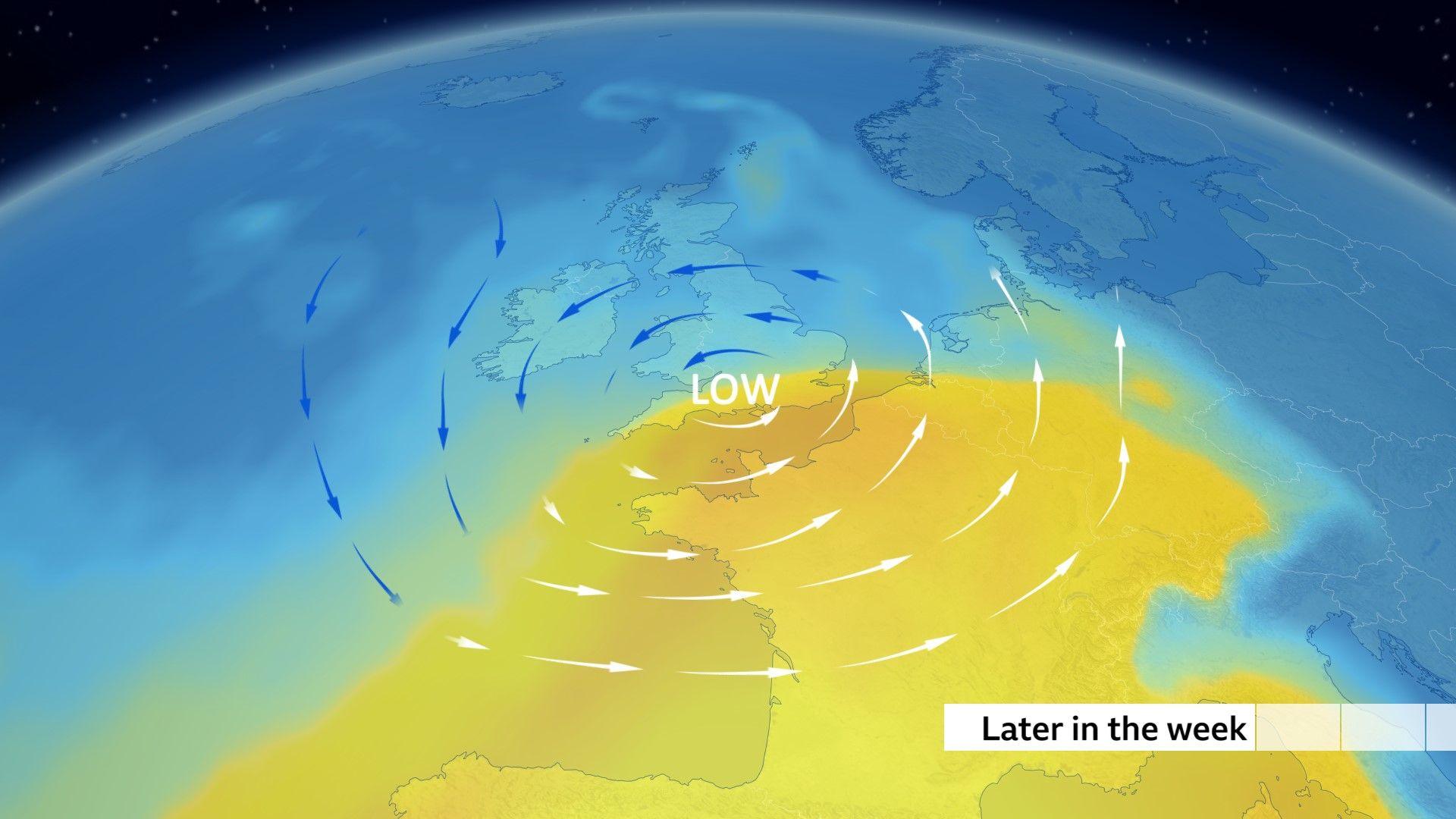
The position of a low pressure system later this week will be key to where we will see snow, sleet or heavy rain
Towards the end of the week, a greater temperature contrast is expected across the UK as a deep area of low pressure swings in, fired up by an active jet stream overhead.
It is too early to say exactly when and where this area of low pressure will cross the UK, however. The track will be crucial as there is likely to be a spell of heavy snow on the northern edge of the low and heavy rain to the south. Strong winds may also bring some disruption too.
Keep up to date with the latest BBC Weather forecasts on the app and online.