 11 hours ago
10
11 hours ago
10
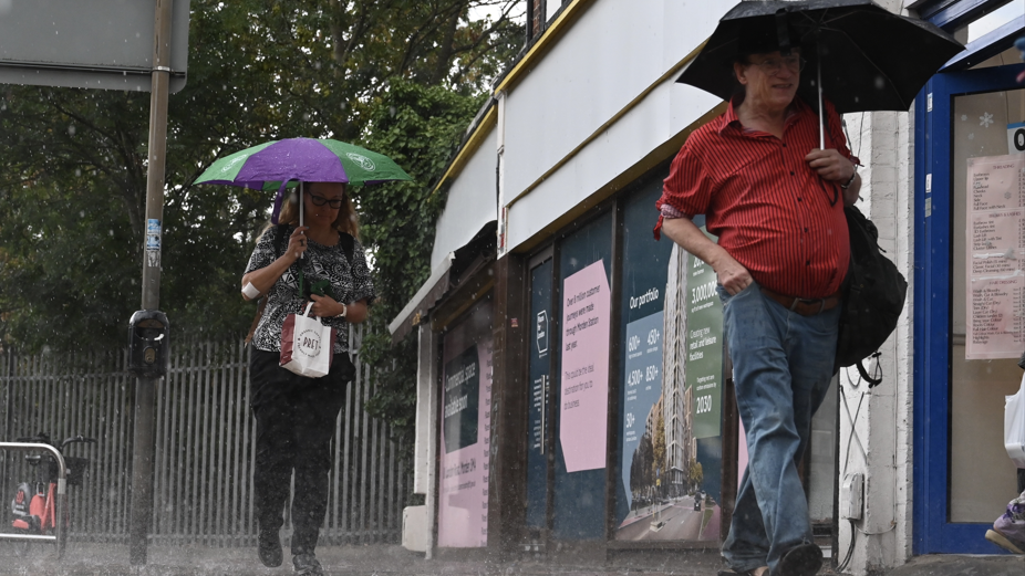 Image source, Anadolu via Getty Images
BySarah Keith-Lucas
Lead Weather Presenter
The weather is set to turn more unsettled this week as rain returns with a chance of thunderstorms and localised flooding.
Some places could see a return to showery conditions by Tuesday, but it is from Wednesday onwards that more widespread and persistent rain will arrive from the south.
The wet weather will be welcome for parched regions of the UK, but a lot more will be needed before drought conditions start to ease.
Temperatures will also be on the rise once more, as warmer air moving in could push midweek highs close to 30C (86F) in places.
Thunderstorm and flood risk to increase from midweek
While drier conditions will continue into Monday for most places, Tuesday will see low pressure arriving from the south-west. This will bring showery conditions for parts of southern England and south Wales.
By Wednesday, downpours will become more widespread across England, Wales and Northern Ireland, while Scotland is likely to remain mostly dry.
There could be some heavy and thundery bursts.
From later on Wednesday until Friday, the threat of torrential downpours with hail and thunderstorms will increase.
The areas most at risk are southern England and Wales, where heavy rain falling on dry and hard ground may bring the risk of localised flooding.
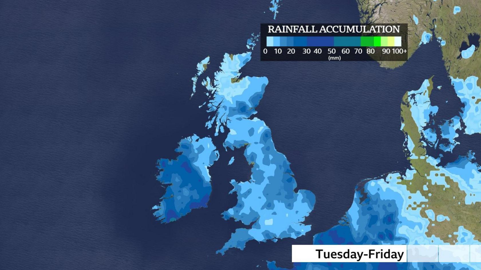
Wet weather is expected in most places at times between Tuesday and Friday although amounts will vary considerably due to the showery nature of the rain.
Will the rain improve drought conditions?
Although this week's rainfall is welcome and will go some way to help river levels and soil moisture content, it will take time for catchments and reservoirs to fully recover.
Droughts tend not to end quickly after one period of rainfall. A drought will only officially end when rain, soil moisture, river levels and groundwater levels all return to normal conditions for the time of year.
According to the British Geological Survey (BGS) "significant, cumulative rainfall over a period of time" is needed.
However, as rainfall moves slowly through the water cycle, aquifers and groundwater stores have shown resilience, external throughout this current drought.
Out of the 35 groundwater sites recently surveyed by the BGS across the UK, only eight (23%) are showing notably low levels.
Warmth to return as temperatures near 30C
Despite the return of wet weather this week, warmer air, pushed up from southern Europe, will return.
Temperatures in Scotland and Northern Ireland will reach around 20C by Wednesday. In England and Wales, 28 or 29C is possible towards the south-east.
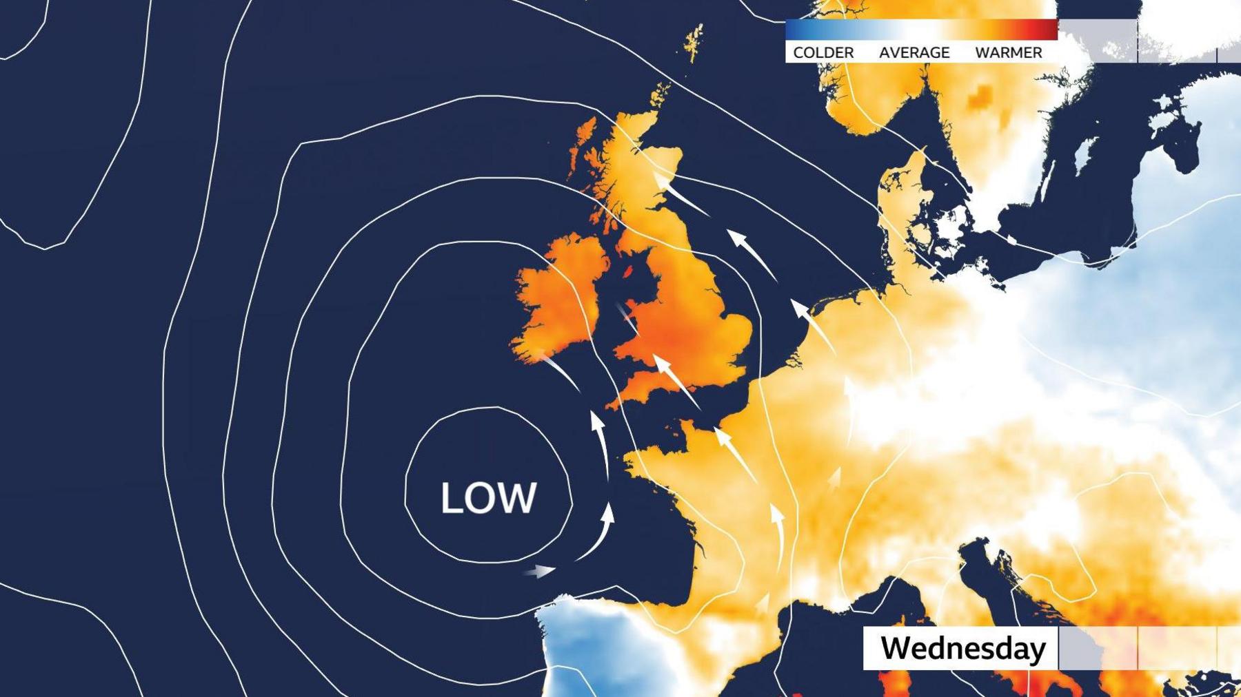
Midweek temperatures will be above average as low pressure to southwest will push warmer air across the UK
The heat is expected to be fairly short-lived though and temperatures are unlikely to reach heatwave thresholds again before the end of August.
Further ahead, some computer models are hinting at higher pressure building into the second week of September which may push warmer air towards the UK again.
The highest temperatures are expected across southern England.
Keep an eye on the monthly outlook for our latest thoughts on the long-range forecast.