 3 months ago
62
3 months ago
62
 Image source, BBC Weather Watchers/Graciegirl
Stav Danaos
Lead Weather Presenter
The recent blocked weather pattern that has brought prolonged cold and grey weather to the UK is finally coming to an end with some warmth on the way.
Cold easterly winds will be replaced by much milder south-westerly winds that will bring an end the recent cold and gloomy weather.
By the end of the week, temperatures will be above average across the whole UK. The country is even expected to be warmer than Greece, which is currently experiencing an unusually cold spell.
However, the milder weather is not likely to bring temperatures approaching the 21.2C (70F) monthly record that was set on 26 February 2019 in Kew Gardens.
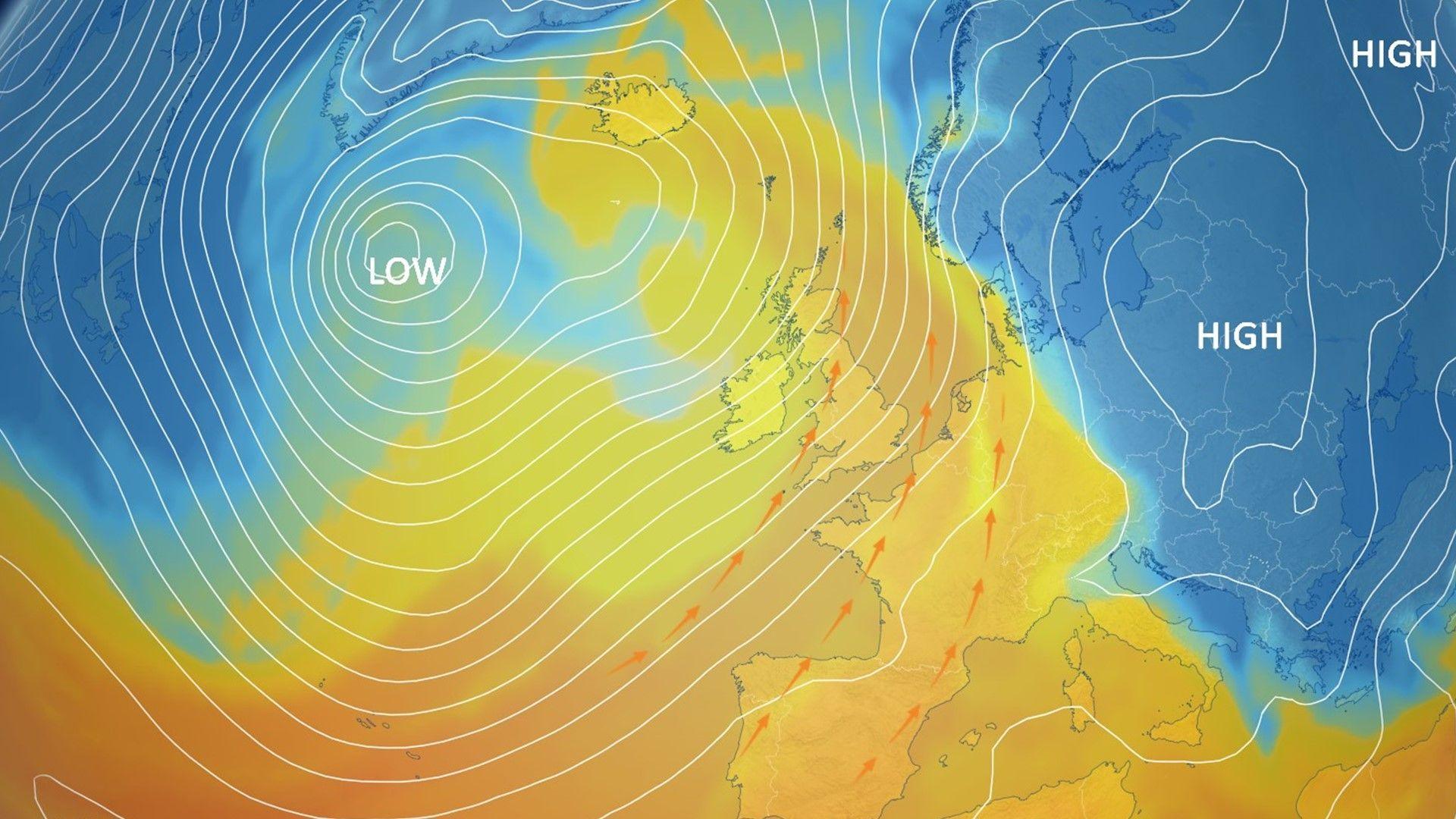
Warmer air will move up from Spain and Portugal in the next few days
How much warmer will it get?
Temperatures will begin to slowly climb on Wednesday with values expected to rise into double figures for all by the end of the week.
A few locations in eastern England may even see highs of 15 to 16C (59 to 61F) on Friday. Average maximum temperatures here in mid February usually sit at around 9C (48F).
The warmer plume of air will bring milder nights with no frost expected later in the week and over the weekend.
This will also lead to a fast thawing of snow and ice that has blanketed many northern hills for more than a week now.
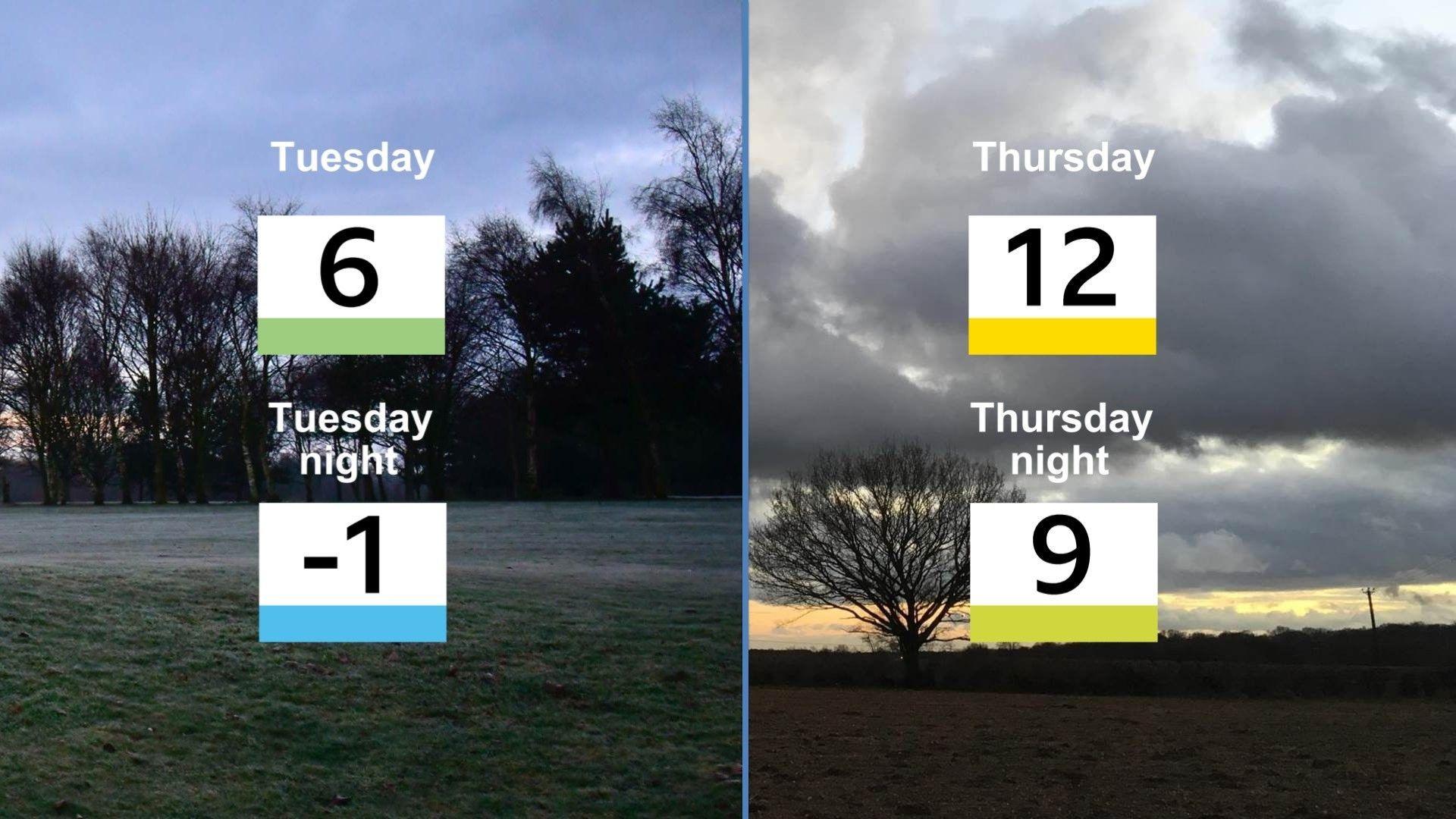
Day and night temperature comparisons in Celsius from the start to the end of this week for the UK
How long will it last?
With low pressure in the Atlantic now in the driving seat, conditions will become more unsettled for all with spells of wet and windy weather forecast, especially across western parts.
Met office yellow warnings for wind and rain have already been issued for parts of the western UK in the coming days. There is a chance that these warnings might be upgraded this weekend, as there is the risk of a deep low tracking to the north of Scotland on Sunday, which could result in the first named storm of this month.
The last week of February is expected to remain unsettled with spells of wet and windy weather or sunshine and showers.
The weather will be more typical for the end of winter. Temperatures are likely to drop back to nearer normal and nights will become chillier again.
How unusual is this?
It is not unusual to see temperatures fluctuate from cold to hot or vice versa during the winter or any season in the UK.
Temperature fluctuations arise directly from how the jet stream - the fast-moving ribbon of air high up in the atmosphere - behaves.
The BBC Weather app will show you how temperatures will change around the country and our latest weather for the week ahead is here.