 3 months ago
81
3 months ago
81
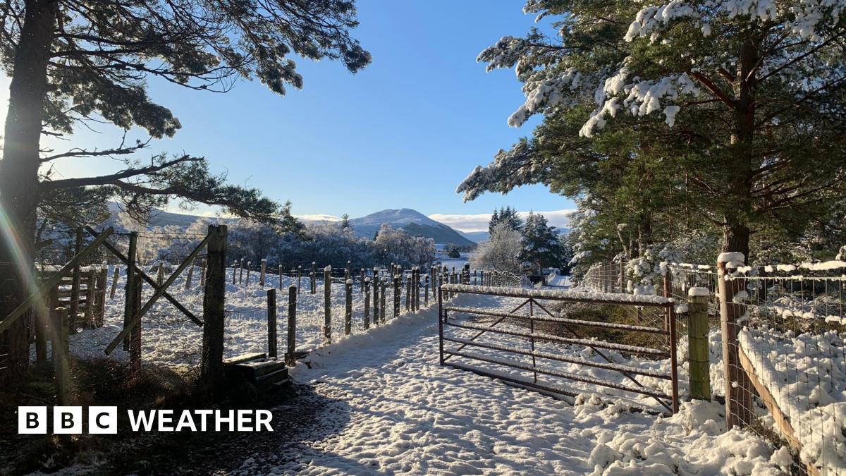
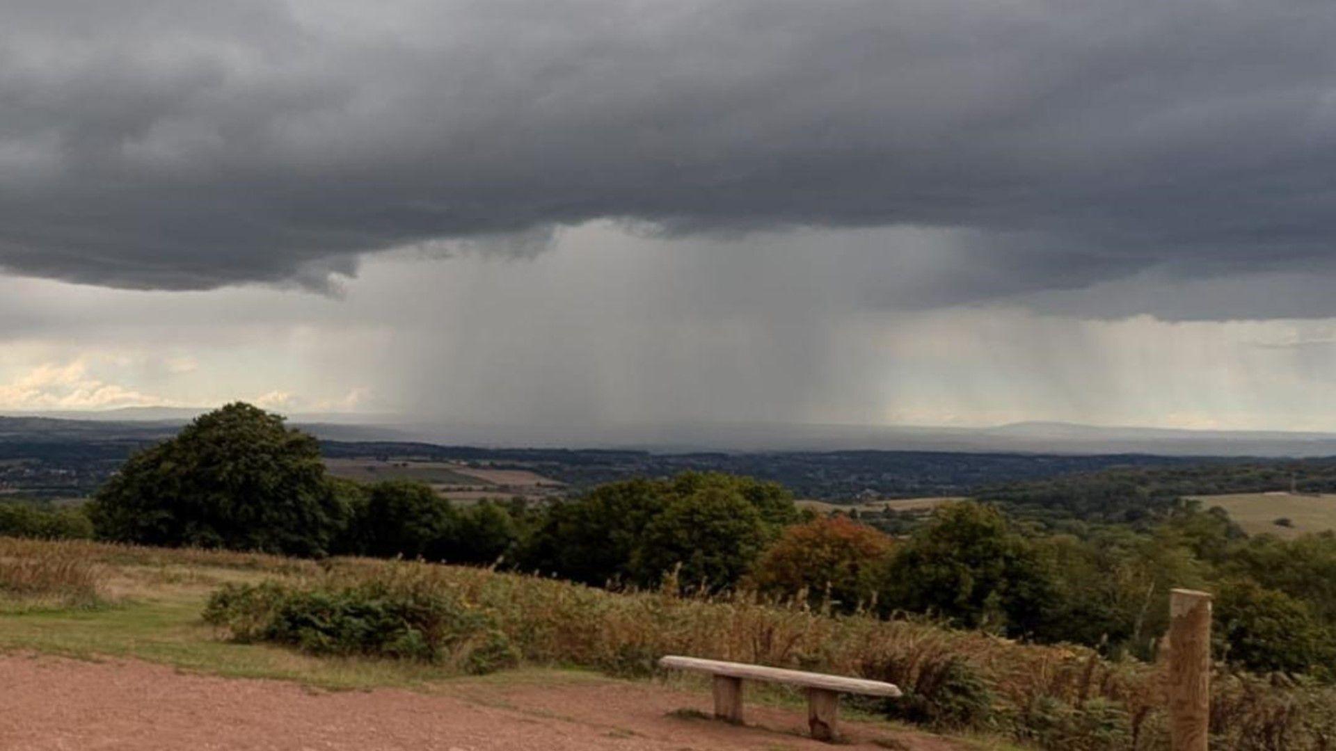 Image source, BBC Weather Watchers / deanogenlly
BySarah Keith-Lucas
Lead Weather Presenter
Autumn has arrived and is making its presence known with an unsettled start to September.
Wind and rain are set to sweep in from the Atlantic on Wednesday bringing about a drop in temperature and a risk of thunderstorms.
The weather will remain unsettled into the weekend with a chance of deeper areas of low pressure developing in the North Atlantic during the coming days
Currently it's too early to be exact about the impact these lows may have - including if any will develop into a named storm. If that happens then the first storm of the season would be called 'Storm Amy'.
You can keep up to date via the BBC Weather app or by following our latest forecast.
Why the change in weather?
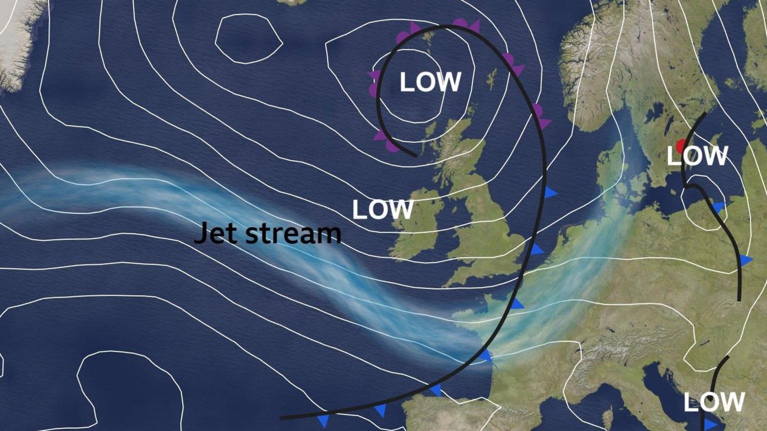
The jet stream will shift to the south of the UK allowing areas of low pressure to move in from the west
The jet stream - a fast moving ribbon of air in the upper atmosphere - is going to be moving to the south of the UK this week and strengthening in speed. This will allow developing areas of low pressure to drift eastwards bringing rain and wind to all areas.
Through much of spring and summer, the jet stream was stuck further north in a 'blocked' pattern which often kept rain-bearing weather fronts away. However, as it often the case this time of year, as we transition out of summer and into autumn, we're now seeing a more westerly influence to the weather. The blocked pattern has broken down and this has opened the doors for Atlantic weather systems to move in.
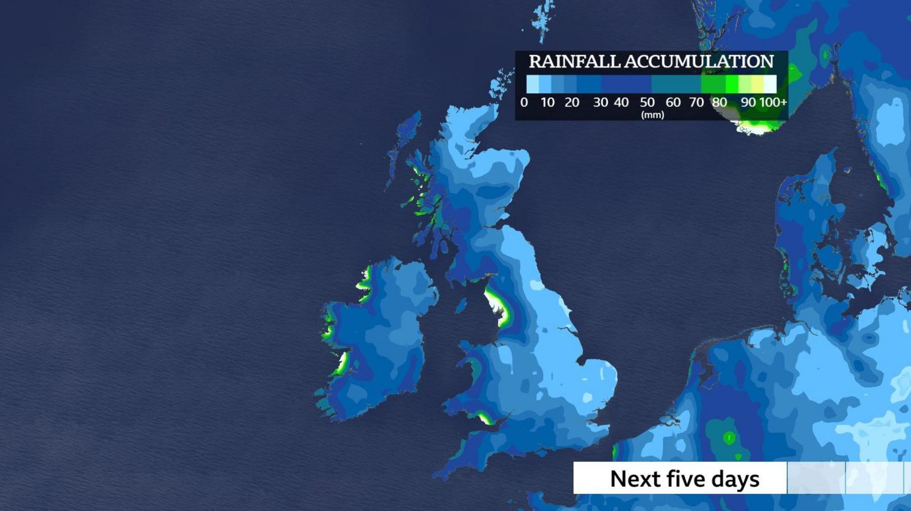
Rain is on the way for all of us this week with the wettest weather likely around the western coasts
What is the longer range forecast?
As we head deeper into the autumn months, most forecast models indicate an increased chance of a 'wetter than average' spell from September to November in the UK. However there is always a lot of uncertainty in seasonal forecasts, and these should be interpreted as likely trends rather than expected conditions.
It's unlikely we'll see a repeat of September 2024 which was the wettest on record for 10 English counties, including Bedfordshire, Buckinghamshire and Wiltshire. They received more than 3 times their expected September rainfall leading to widespread flooding.
Will the rain help relieve the drought?
This year so far, the UK has experienced its sunniest spring and warmest summer on record. Both these seasons have also been very dry for many, especially for some regions of England and Wales, where hosepipe bans remain in force and drought has been officially declared.
The data from January to August shows that the UK as a whole has received just 44% of its expected annual rainfall (compared to an expected average of 67% by this stage in the year).
If we were to reach 'normal' rainfall totals by the end of the year, we'd need to see a very wet spell of weather from September to December, with 141% of average rainfall each month.
Although this week's rainfall is welcome and will go some way to help river levels and soil moisture content, it will take some time for catchments to recover and for reservoirs and aquifers to respond. Rainfall moves slowly through the water cycle, needing to soak deep through the soil and way down into the groundwater stores.
According to the Met Office "Sustained rainfall throughout autumn and winter will be needed in some areas to restore water resources.".
As our world warms, climate scientists expect the UK to experience wetter, warmer winters and hotter, drier summers. Although the distribution and intensity of the UK's rainfall is shifting, the link between climate change and drought is complex due to hydrological and societal factors.