
 3 months ago
65
3 months ago
65
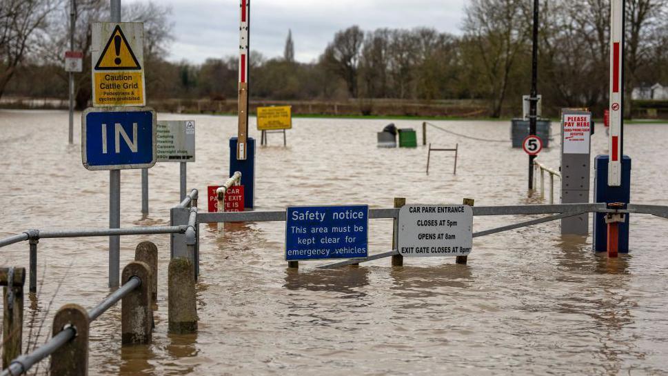 Image source, Getty Images
Matt Taylor
Lead Weather Presenter
The Met Office has issued severe weather warnings for wind and rain across many parts of the UK, including an amber warning for rain across much of south Wales, where some flooding and travel disruption is expected.
Winds of more than 70mph (112km/h) have also been recorded in parts of Wales and Scotland, adding to the impact on travel on Sunday.
Met Office warnings
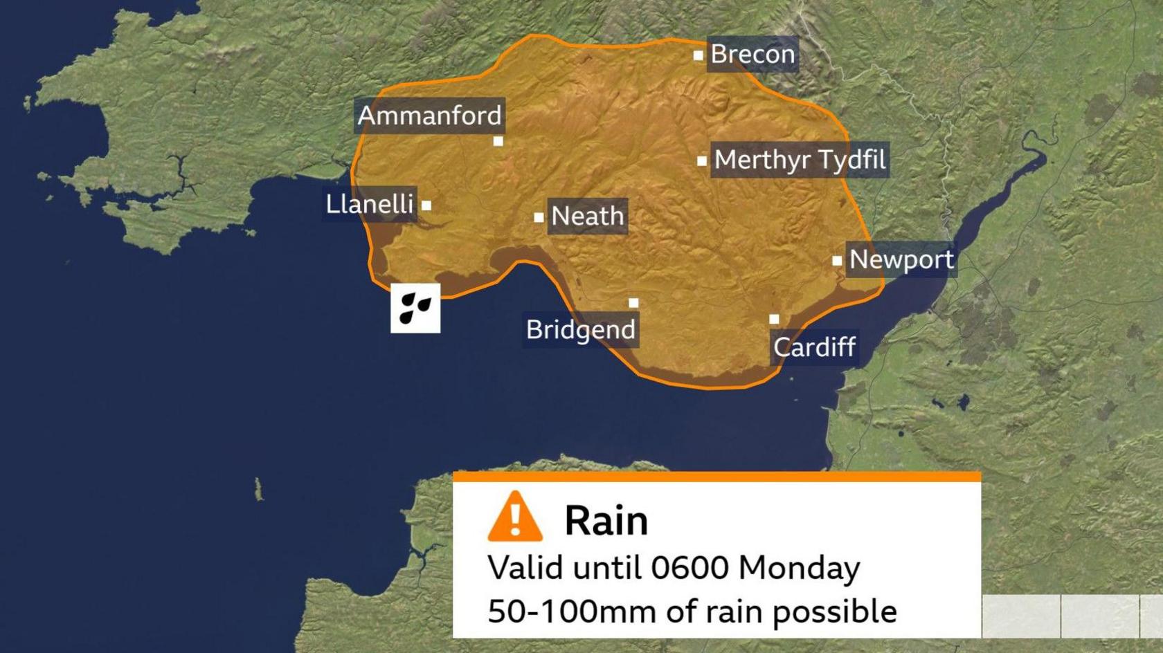
An amber warning has been issued for rain across much of south Wales
In south Wales, areas badly hit by Storm Bert in November are among those now covered by the Met Office amber weather warning for rain.
With the warning valid from 15:00 GMT on Sunday to 06:00 GMT on Monday, the Met Office expects between 50mm and 100mm of rain may fall during this period.
In addition to travel disruption, they also warn that flooding has the potential to be a "danger to life", that homes and businesses may become flooded and some communities could become cut off.
Lesser yellow weather warnings for rain have also been issued more widely across the country.
Met Office yellow warnings for rain on the hills of south-west Scotland expire at15:00 GMT on Sunday, and the Lake District at 19:00 GMT.
However, yellow warnings for rain across the southern half of Wales and southwest England will remain in force until 08:00 GMT on Monday.
Some 20mm to 50mm of rain (0.8 to 2in) could fall during the course of the warnings, with up to 100mm (4in) possible on south-facing hills. This may lead to localised flooding, travel and power supply issues.
Widespread warnings for strong winds
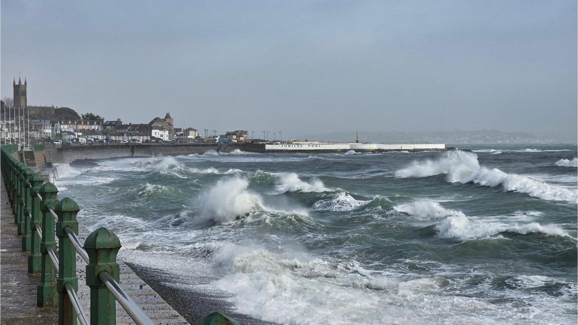 Image source, BBC WEATHER WATCHERS
Travel disruption has already occured due to strong winds
Winds on Sunday morning have already gusted to 74mph (119km/h) at South Uist (Western Isles) and 72mph (116km/h) at Capel Curig (Gwynedd), leading to travel disruption in some areas.
A yellow warning for wind in Northern Ireland expires at 15:00 GMT, with gusts of 50-60mph (80-96km/h) expected.
For a larger area across Scotland and England, a yellow warning will be valid until 18:00 GMT, with further gusts of up to 70mph (113km/h) possible.
According to the Met Office delays to road, rail, air and ferry transport are likely. Power cuts are also possible.
 Image source, BBC WEATHER WATCHERS
It has felt like spring for some over the past few days, with temperatures hitting 17 Celsius (63F) in eastern parts of the UK
Why has it turned wet and windy again?
The weather for much of the month so far has been dominated by an area of high pressure stuck over central and northern Europe.
This prevented rain-bearing Atlantic weather systems from reaching us and was also responsible for the continuous influx of cold air from the east, which kept daytime temperatures below normal for this time of year.
However, recently we have seen another surge of frigid arctic air across Canada and the US which has helped fire up a strong jet stream across the Atlantic.
While the jet stream will weaken next week, we will still see our weather come in from the Atlantic, rather than from Europe.
This will lead to fairly changeable conditions and temperatures closer to the seasonal average of 7 to 10 Celsius (45 to 50F). On the clearer nights we will also see the return of a frost in places.